Bosch Unveils Vehicle Motion and Position Sensor
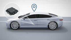
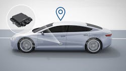
Automated driving requires highly precise, reliable, and safe vehicle localization. Bosch has developed a vehicle motion and position sensor that allows automated vehicles to precisely determine their position. First presented at the 2019 North American International Auto Show (NAIAS) in Detroit, the sensor includes a high-performance receiver unit for global navigation satellite-system (GNSS) signals, which an automated vehicle needs to determine its absolute position.
The challenge with satellite-based positioning lies in dealing with inaccuracies in the data. GNSS satellites orbit the earth at a distance of 25,000 km and at speeds of 4,000 meters per second. As their signals make their way to the ground, they must pass through the ionosphere and layers of clouds in the troposphere, which disperse the signals and introduces errors.
While the signals are still accurate enough for today’s navigation systems, they don’t meet the needs of automated driving. This is why Bosch set up the Sapcorda joint venture in 2017, in which Bosch, Geo++, Mitsubishi Electric, and u-blox established Sapcorda Services to bring high-precision GNSS services to mass markets.
Combining and Processing the Data
The new vehicle motion and position sensor brings together the GNSS position signals, correction data, and information from the inertial sensors—specifically, the wheel-speed sensors and the steering-angle sensor. However, this information alone isn’t sufficient for the exact localization of automated vehicles. For precise positioning, the data needs to be processed using intelligent software. Only then can an automated vehicle reliably know exactly where it is within an area stretching several meters around it, and then calculate its driving maneuvers accordingly.
Bosch meets safety requirements for automated driving by combining a satellite- and vehicle-motion and position sensor-based approach with map-based localization services. These elements serve as a redundant system for precisely determining the vehicle’s position.
On the subject of automated driving, like other global suppliers of technology and services in the automotive industry, Bosch is devoting significant effort into its “road signature” system to help further develop the high-resolution maps that are essential for self-driving vehicles.
Video and radar sensors on board vehicles in motion generate the Bosch road signature by detecting stationary features on and by the road, such as lane markings, traffic signs, and guardrails. For their part, automated vehicles would detect the road features around them and consult the map to see whether the traffic signs or guardrails they have recognized match those recorded there. This comparison enables a car to accurately determine its position in the lane—relative to the highly accurate map—down to the nearest centimeter.
“Services are at least as important for automated driving as the hardware and software,” said Bosch board of management member Dr. Dirk Hoheisel. “We must pursue all three paths simultaneously to get self-driving cars safely and reliably onto our roads.”
Software plays another key role. An automated vehicle is localized primarily on the basis of the corrected GNSS signals. If the satellite connection is lost, for instance when the vehicle enters a tunnel, the vehicle motion and position sensor can continue to determine the vehicle’s position for several seconds. This involves calculating the vehicle’s position relative to the last known point for which absolute positioning information is available. If the GNSS signal is interrupted for a longer period and it’s no longer possible for the vehicle motion and position sensor to determine the vehicle’s position, the automated vehicle can refer to the Bosch road-signature system for localization information.

About the Author
Murray Slovick
Contributing Editor
Comment About the Article
To join the conversation, and become an exclusive member of Electronic Design, create an account today!

Leaders relevant to this article: