Mitigating Satellite Drift: How Engineers Keep GPS and Comms from Falling Silent

What you'll learn:
- How does satellite drift affect GPS?
- How does satellite drift affect communications?
- Will GPS become unusable in the upcoming decades?
- What can we do besides launch more satellites into space?
If you think about it, space-based satellites are a pinnacle of human engineering. Above that, some are part of the Global Positioning System (GPS), winning 10 awards for that achievement in technology. Saving lives, guiding militaries, or just finding your way to a new restaurant, we all use it just about every day.
However, these satellites sometimes don't stay in place. This is a phenomenon called satellite drift, and it’s a big problem. There are many causes, including gravitational forces, solar radiation pressure, atmospheric drag at lower altitudes, and imperfections in the Earth's shape. With that said, will satellite drift render our GPS capabilities useless?
How Does Satellite Drift Affect GPS?
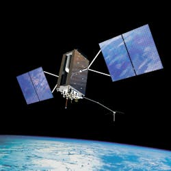
GPS satellites (Fig. 1) are deployed in medium Earth orbit (20,200-km altitude and two orbits/day). Such a high orbital position enables them to provide global coverage through their constellation. But they must be precisely and timely positioned to provide accurate navigation. And factors like satellite drift can affect it.
For instance, ephemeris errors occur if the satellite's position doesn't match its predicted path provided in the broadcast data. Ground control systems that use observational data and force models calculate the predicted path. These errors produce positioning inaccuracies because GPS receivers rely on ephemeris data to determine the satellite's position during signal transmission.
Although operators apply updates to reduce positional drift, tiny inaccuracies can remain, resulting in additional errors of approximately 2 to 5 meters. Before 2000, more extreme cases caused significant drift, up to 50 meters, due to selective availability (SA), which involved intentionally degrading GPS signals. Thanks to enhanced satellite modeling, atomic clock stability, and real-time updates, systems ensure those GPS errors remain within ±2.5 meters.
>>Download the PDF of this article

Satellite drift also alters signal geometry, potentially amplifying multi-path interference. Thus, GPS may be less precise in urban or obstructed areas, where signals bounce off buildings or terrain. Here's how it works.
To calculate their position, GPS receivers measure the signals' time delay as they move from satellites. When these signals reflect off surfaces like buildings, obstacles, or terrain, the receiver's correlation engine characterizes them as direct line-of-sight transmissions. Those delayed signals then introduce false distances, making the receiver think the distance is much farther away than it really is. This is problematic in dense, urban environments (skyscrapers reflect signals) as multi-path errors can accumulate to, or exceed, 15 meters.
Fortunately, receivers have narrow correlator algorithms to determine if it's a true signal or a reflection. They also feature multi-antenna arrays that filter noise, providing more precision for navigation, even in concrete-heavy areas.
There's also dilution of precision (DOP), a measurement of how satellite geometry impacts the accuracy of a GPS positional fix. Satellite drift affects DOP by gradually altering the constellation geometry. It happens regardless of perfect signal transmission timing or strength.
While moving away from their intended orbital slot, the satellites may become unevenly distributed or cluster too close together, leading to poor angular separation. This increases horizontal and vertical DOP values, which means that slight timing or orbital errors are magnified, resulting in inaccurately calculated location data. A DOP of over 10 is bad (more error-prone), 5-10 is moderate, 2-5 is good, and less than 2 is excellent.
At least four satellites transmit signals to GPS receivers to calculate position via trilateration, a very sensitive process to the spatial distribution of those satellites.
How Does Satellite Drift Affect Communications?
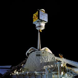
Similar to GPS satellites, orbital drift causes communication satellites (Fig. 2) to move out of their assigned positions. This displacement leads to signal loss/degradation, increased interference, and possible service interruptions, especially for geostationary communication networks that require precise satellite alignment.
While orbiting, communication satellites must remain in a fixed position aligned with a specific ground location. Drifting may put the satellite outside the ideal beam coverage zone, causing signals to weaken before reaching the ground receivers. This affects data-transmission speeds, interrupts broadcasts, and degrades call quality.
Ground antennas can also be impacted, as they’re no longer precisely aligned in this scenario. This is bad news since the receiver operates close to the satellite's beam footprint, which has a lower signal quality. Systems may try to make up for this issue by reducing data rates or relying on stronger, slower transmission modes to maintain connectivity.
In addition, communication satellites' RF beams may intersect with nearby satellites that have similar frequencies. Overlapping signals like these tend to result in cross-satellite interference, thus decreasing the signal-to-noise ratio (SNR). Communication then becomes less reliable and nonfunctional in extreme cases, because the interference may overpower the weak signals.
Typically, satellite systems rely on frequency reuse schemes, which involve reutilizing frequencies across various beams. In this case, slight shifts generate unpredictable co-channel interference, where isolated beams interfere with one another. Operators combat this problem by frequently tracking satellite positions and fine-tuning beam shapes, power levels, or user handoffs, effectively diminishing the interference produced by drift.
Narrow, high-frequency (Ka-band or satellite internet) beam systems are also affected as drift moves satellites out of the ground-station antennas' range. When this happens, user terminals or ground stations no longer have a lock on the satellite signal. It leads to broadcast disruptions, dropped connections, or service outages until the terminal locks onto the signal again.
Some ground stations and user terminals deploy tracking antennas that follow a small drift. However, too much drift causes those antennas to lose track of the satellites.
Service delays may occur if the ground stations don't reconnect with the satellites right away. Networks relying on uninterrupted satellite handover from satellite to satellite may experience higher-frequency handovers due to drift. This can ultimately degrade service quality even further.
Will GPS Become Unusable in the Upcoming Decades?
Despite speculation, GPS won't become obsolete in the future. Sure, satellite drift, signal errors, and aging satellites contribute to GPS inaccuracy—all of which are actively managed. Ground-control stations use tracking, telemetry, and command (TT&C) systems to constantly track satellites, updating navigation messages with new ephemeris and clock corrections to maintain their positioning.
There are valid concerns about GPS interference, including jamming and spoofing. Jamming, which uses radio signals to disrupt satellites, causes receivers to lose positioning and navigation services. It has occurred more often these days, even in regions with geopolitical tensions. On the other hand, spoofing, a growing threat, involves sending fake GPS signals to receivers, causing them to function improperly.
To address those potential jamming and spoofing threats, multi-sensor navigation systems (combining GPS with cellular, Wi-Fi, inertial sensors, or visual data) are being developed to ensure navigation services remain functional if GPS signals are compromised.
In addition, GPS is undergoing upgrades with the introduction of L2C, L5, and L1C—new civilian signals that enhance satellite performance and positioning accuracy. L5 is transmitted at higher power and in a protected aeronautical radio-navigation band to enable sub-meter accuracy when combined with other signals, such as L2C and L1C. It also makes GPS more reliable for critical applications.
What Can We Do Besides Launch More Satellites into Space?
Beyond launching more satellites to correct drift, efforts are continuously underway to manage and combat satellite drift. For starters, satellites feature small onboard thrusters that keep them in position and in their orbital slot if drift ever occurs. It's typically used for geostationary and MEO/GEO (medium Earth orbit/geostationary earth orbit) satellites.
However, this method uses fuel, even for minor corrections, which shortens the satellite's lifespan. When it runs out of fuel, the satellite can't stay in position, causing it to drift out of alignment and become inoperable.
Engineers are deploying alternative propulsion systems like ion thrusters and electric propulsion (Fig. 3) for longevity and efficiency. These don't require as much propellant as chemical thrusters, so that satellites can make slight adjustments over a long period. Satellites can then perform station-keeping maneuvers and correct orbital drift without consuming a lot of fuel, extending their lifespan.

Autonomous onboard navigation (built-in sensors and AI autonomy) is deployed on satellites to detect and correct positional changes caused by drift. Constellations like Starlink feature that capability. Starlink satellites have GPS receivers and sophisticated algorithms that accurately calculate their positions, enabling reliable navigation and possible autonomous adjustments.
AI and machine learning are used for satellite telemetry and environmental data analysis. These can enable real-time orbital correction while minimizing fuel consumption.
Large constellations like OneWeb also use laser or radio-frequency inter-satellite links for back-and-forth communications between satellites. With these links, data is transmitted through nearby satellites to provide multiple routing paths in case they drift out of position or lose contact with ground stations. Such a satellite network reduces dependency on ground infrastructure and ensures service availability during disruptions or satellite adjustments.
Moreover, better ground receiver technology helps mitigate satellite drift. Antennas with auto-tracking capabilities can regularly fine-tune their position to match minimal satellite movements, ensuring signal alignment remains intact.
Other methods like beamforming and multiple-input, multiple-output (MIMO) boost signal reception by dynamically steering and broadening antenna beams, helping maintain reliable communication during drift. Error-correction algorithms prevent additional data loss from misaligned signals, ensuring reliable communications.
And the Wide Area Augmentation System (WAAS) enhances navigation system positional accuracy. It works by using a network of ground stations that track GPS signals and detect errors related to satellite drift. Geostationary satellites then receive corrections for those issues that are transmitted to users over extensive areas, boosting precision.
>>Download the PDF of this article
About the Author

Cabe Atwell
Technology Editor, Electronic Design
Cabe is a Technology Editor for Electronic Design.
Engineer, Machinist, Cartoonist, Maker, Writer. A graduate Electrical Engineer actively plying his expertise in the industry and at his company, Gunhead. When not designing/building, he creates a steady torrent of projects and content in the media world. Many of his projects and articles are online at element14 & SolidSmack, industry-focused work at EETimes & EDN, and offbeat articles at Make Magazine. Currently, you can find him hosting webinars and contributing to Electronic Design and Machine Design.
Cabe is an electrical engineer, design consultant and author with 25 years’ experience. His most recent book is “Essential 555 IC: Design, Configure, and Create Clever Circuits”
Cabe writes the Engineering Life & Engineering on Friday blog on Electronic Design.
See Cabe's cartoons & comic strips here.
Comment About the Article
To join the conversation, and become an exclusive member of Electronic Design, create an account today!

Leaders relevant to this article: