GaN Devices Power the Next Generation of LiDAR Systems (.PDF Download)
>> Website Resources
.. >> Library: TechXchange
.. .. >> TechXchange: LIDAR Technology
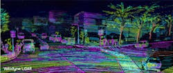
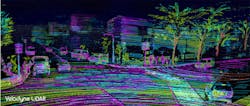
The goal of a sensor is to gather data about a real-world parameter and convert it to electrical form. Needless to say, the techniques for doing that take many forms, but the standard method to determine distance measures the time taken for a transmitted signal to travel to a target object and be reflected back to an adjacent receiver. The signal can be acoustic, as in a sonar or ultrasonic system, or electromagnetic (EM) waves, i.e., radar (radio direction and ranging) and LiDAR (light detection and ranging) (Fig. 1).
1. The latest automotive LiDAR systems provide a detailed image of a vehicle’s surroundings (Source: Velodyne)
Both radar and LiDAR systems transmit and receive EM waves. As its name suggests, a radar system uses radio-band frequencies up to several hundred gigahertz (Fig. 2). LiDAR, though, operates at much higher frequencies: the portion of the spectrum from near-infrared (IR) to visible blue light. Because LiDAR’s higher frequencies in turn provide higher resolution, it’s widely used for topographical mapping, adaptive cruise control, and emergency braking. Furthermore, it’s expected to play a key role in collision-avoidance systems in autonomous vehicles.
2. LiDAR and radar operate on similar principles, but use radically different wavelengths. (Source: radartutorial.eu)
Figure 3 shows the block diagram of a LiDAR system for simple distance measurements using the time-of-flight (ToF) method. Light emitted by the laser is first focused by a lens to create a narrow beam, which then travels to the target, is reflected, returns, and is focused on the detector by a second lens. The laser driver and stimulus subsystem can be designed to apply pulsed or amplitude-modulation (AM) waveforms.
>> Website Resources
.. >> Library: TechXchange
.. .. >> TechXchange: LIDAR Technology


